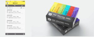
Reading-taking Application
Cenco Consultancy has developed for its clients a reading application that incorporates the latest technologies with the aim of improving the quality and productivity of the field staff that performs the reading Activities.  The module is intended for utilities companies that have to carry out mass readings of meters (energy, gas, water, etc.). The use of GPS, photo taking and online connections allows to optimize the reading process as well as to guarantee the best quality of the Reading.
Scope
The application, which has integration with commercial systems, allows to download several reading paths which can be seen in Google maps for a better organization of the tasks of the Reader. The reading is simple and optimized for sequential or alternating reading of one-route meters (or several). The captured reading has "on-site" controls to ensure an entry consistent with the historical, allowing the information of incidents both in case of not being able to take the reading or in conjunction with the Reading. The application allows the loading and unloading of routes by means of data connection, avoiding unnecessary displacements of the readers, to the offices of the Company. The system manages with AIDS and with an optimized navigation, special cases like: more than one meter for the same supply, meters located in the same point (eg: apartment building), meters with more than one type of reading, etc. Parameterization The main parameters of the application-language of the interface. -URL for downloading and loading of routes or readings. -Obligatory and size of the photos captured by the readers. -Type of map (standard, satellite, hybrid)-sequential or discontinuous reading-value and calculation of the necessary amount of readings to consider the path "potentially finished"-upload the reading to the backend immediately when it is taken (invoicing in situ)- Payment option to take the reading using OCR activity indicators the application controls the movements of the reader and presents the statistics of productivity, displacement, etc. It also has a "pause" mode to record the dead times of the working day (eg: lunch). In the area of indicators the information is presented by day and route, allowing to establish parameters of productivity as well as to effectively control the activity of the field personnel. In addition to the indicators, a map is presented with the history of the readings taken in each Route. Technology the application is developed in React Native (it works on Android and IOS) and uses functions for localization management (GPS), maps and photos. The interfaces with the commercial system are implemented as Web Services with sending/receiving in Json Formats.
